
.jpg)


Bicycle Lafayette Master Plan
The Bicycle Lafayette master plan is made up of 7 protected bicycle routes. It is comprised of approximately 50 miles, including just over 3 miles of recreational routes along coulees. The Bicycle Lafayette Master Plan was developed using strategies to build a connected, safe, comfortable and equitable bicycle system. Research was conducted in order to create a system design that would shape the City of Lafayette to be more resilient through design and ensure it is more equitable and inclusive of all regardless of socio-economic backgrounds.
AIA Louisiana 2023 Award of Merit
ASLA Louisiana 2022 Award of Merit
The Acadiana Advocate January 2022
The Current June 2022

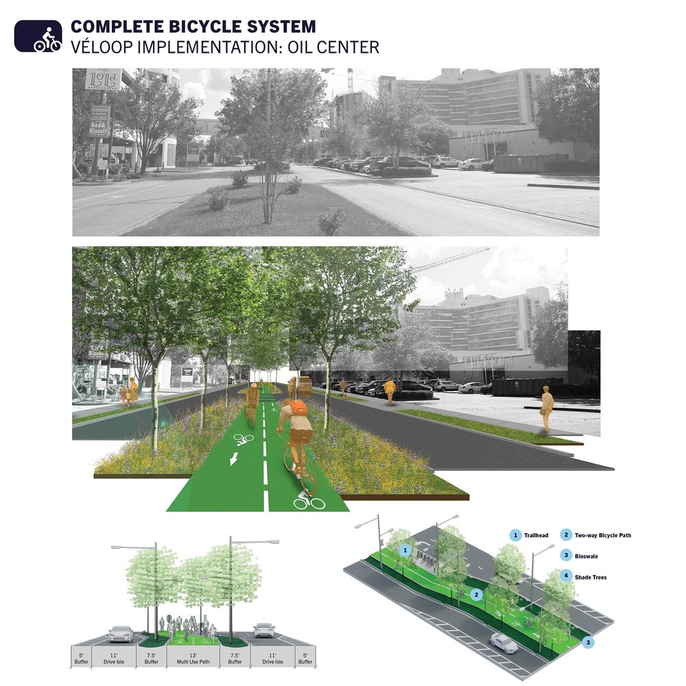
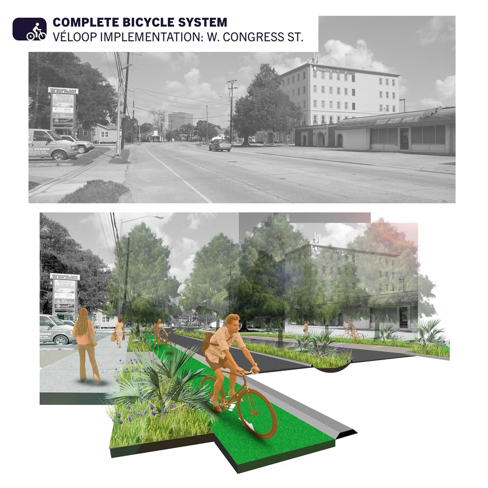
The Bicycle Lafayette Master Plan went beyond just creating a bicycle plan for a city designed around cars. The street design section included updates for multi-modal transportation, mainly focusing on design that considers pedestrians and cyclists.
This design aims for a system that is comfortable, safe, equitable, and connected. Mass transportation was integrated into the plan, while current vehicle traffic counts were taken into account to maintain the necessary number of lanes for smooth traffic flow. The plan also developed a bicycle boulevard type as well as a transit boulevard with bus rapid transit and tram stops included in typical right-of-way sections.

The system is organized around a loop and spoke design, often seen in other modes of transportation and easy for users to understand.
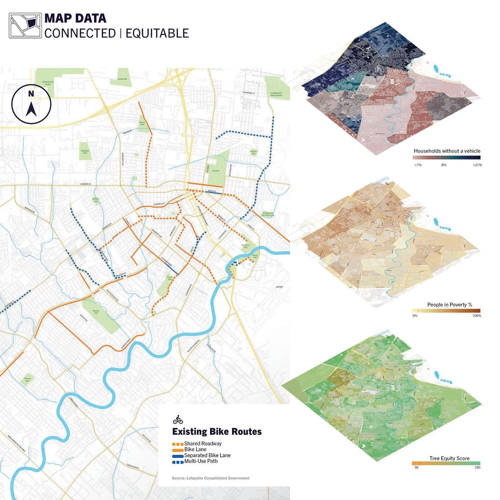
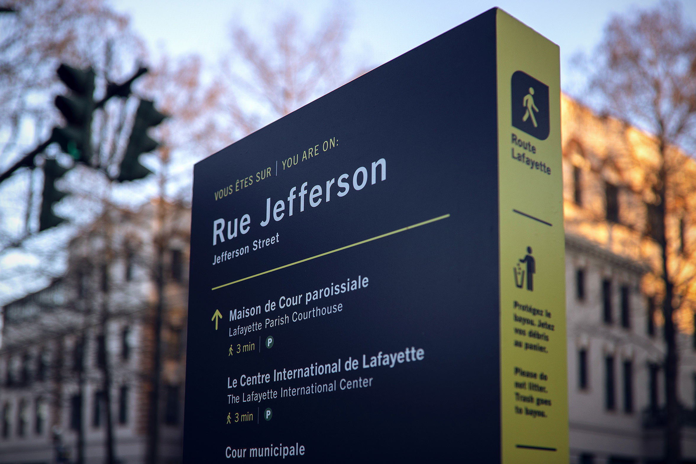
To best organize the Bicycle Lafayette network, routes are color coded and connect specific areas based on data analysis. The color-coded system provides a more effective wayfinding solution with increased branding to encourage use.
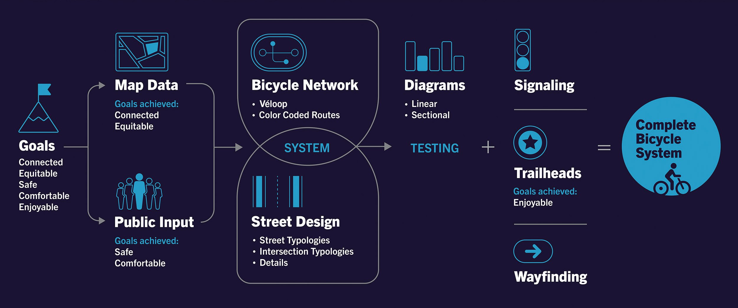
The bicycle system's methodology was to first identify the goals, which were selected and ranked by citizens during public meetings from a list of potential goals. These goals guided the mapping of data, while further public input focused on what was comfortable and safe to ride on. The map data shaped the bicycle network, and the public input influenced the street designs. These elements were then tested using linear diagrams against the five identified goals. The final components to complete the bicycle system included signaling design, trailhead designs, and the wayfinding system, which was further developed from the Route Lafayette project.
Phase 1: Véloop
The proposed first phase of the network is the Véloop, an 8.8 mile loop that blurs the lines between a commuter route and recreational route and connects seventeen distinct Lafayette neighborhoods. This loop was not only a commuter route connecting people to work or recreation but also became an experience itself, blurring the line between a recreational route and a commuter route.

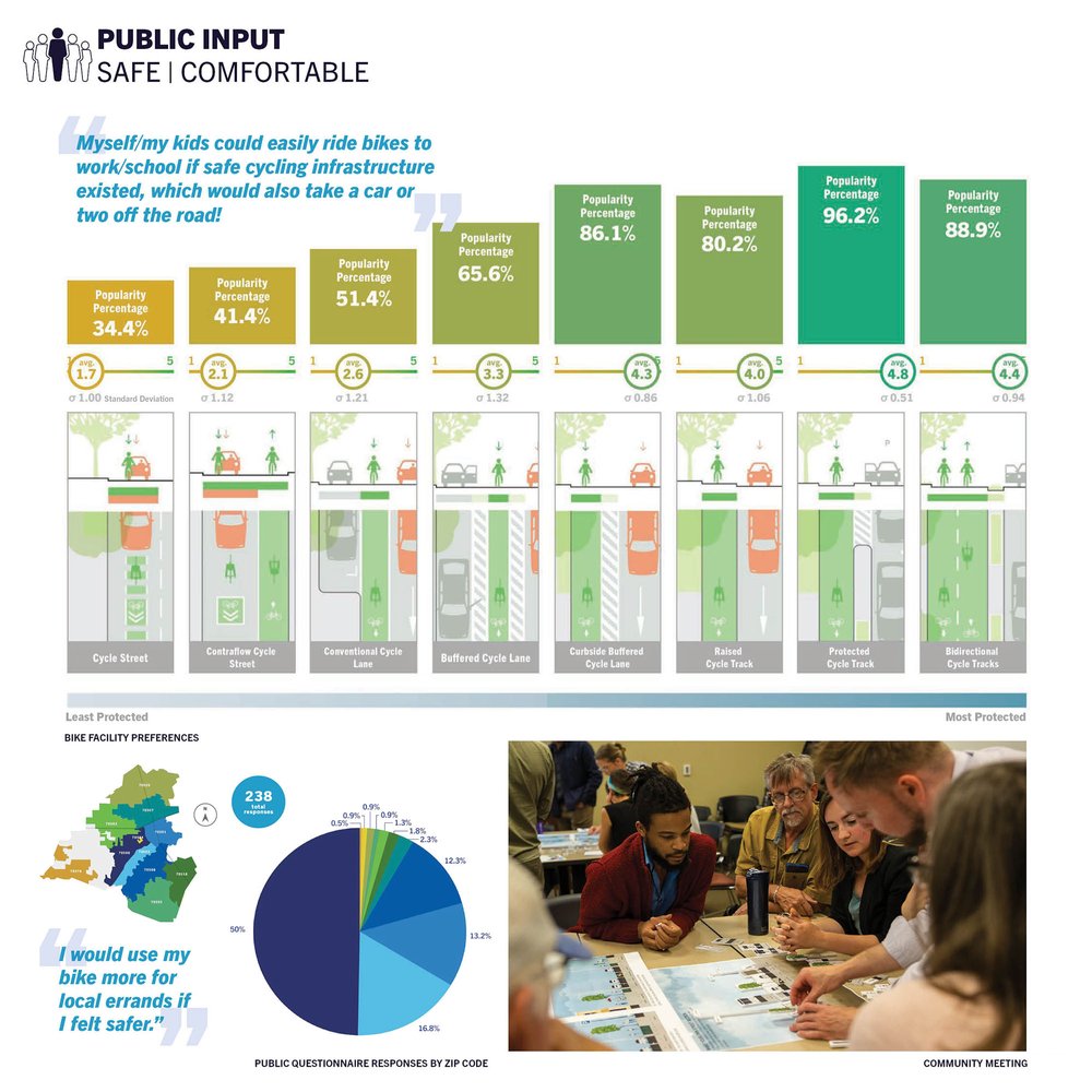
In order to ensure that the first phasing of the Bicycle Lafayette network is complete enough to encourage its use by bicyclists, the public input included several charettes and an online survey. This helped shape the street designs based on community preferences.


The route linear diagrams examined the experience of the route through iconic images of the neighborhoods along the way. It also assessed demographics such as car ownership rates and poverty levels to ensure that the routes connected people for greater opportunities for everyone. Additionally, the zoning was reviewed to see if it aligned with the new street designs.
By stitching together the fragmented community through bicycle infrastructure, the city becomes a space for a more equitable urban environment with upward mobility for often left behind communities. With the overlapping complexities, convergent issues can be confronted or even resolved.
"The Plan clearly communicates a series of urban interventions proposed to improve bicycle access throughout a community. The analysis was supported by design – making it much more than a civil engineering document."
AIA Louisiana Award Jury


The street design resulted directly from extensive public input that showed the need to separate the three main modes of transportation—pedestrian, cyclist, and vehicular—and clearly define crossings for safety and comfort. Mass transit systems were also incorporated into this set of street types, with integrated transit stops and considerations for how they interact with cyclists and pedestrians.

Learn more about Bicycle Lafayette
The plan aims to better meet the goals of Bicycle Lafayette by using data and public input to inform design solutions.
Read the Bicycle Lafayette master plan document by clicking the link below.

.jpg)